Monday, 7 November 2011

FREQUENTLY ASKED QUESTIONS ABOUT URBAN PLANNING

What is Urban Planning?
Urban planning known as the "physical planning" or "land use planning". In other words, it is an art and science in shaping the growth and physical development, social and economic urban areas and rural areas.Urban planning (urban, city, and town planning) incorporates areas such as economics, design, ecology, sociology, geography, law, political science, and statistics to guide and ensure the orderly development of settlements and communities.Prominent features of urban planning are land use planning, zoning, environmental planning and transportation planning. Urban planning can include urban renewal, by adapting urban planning methods to existing cities suffering from decay and lack of investment. In other words, Urban planning is a mixture of science and art. It encompasses many different disciplines and brings them all under a single umbrella. The simplest definition of urban planning is that it is the organization of all elements of a town or other urban environment. However, when one thinks about all the elements that make up a town, urban planning suddenly seems complicated - and it is.

Planning Permission
Planning permission must be obtained from the Local Authority (PBT) before a development can be initiated in accordance with section 19. Application for Planning Permission shall be in such form and containing such particulars, and accompanied by the documents and plans set by local authorities as provided by section 21 (1). Section 21 (3) requires that if the application involves the erection of buildings, the Local Authority may direct the applicant to submit level details such as building sites, building height and shift back and forth.

Aggrieved by the decision of the Planning Permission
May appeal to the Appeal Board within one month from the date of the decision on him.

What is Proposed Development Report?
It is a report required to be prepared in accordance with the provisions of Section 21A, Town and Country Planning Act (Amendment) Act 1995, which must be submitted together with the layout plan submitted either to the application conversion, subdivision or erect buildings where relevant. It presents the fundamentals of planning, rational rationale and justification that would strengthen the suitability of development proposals.

What is the Local Plan?
Is a detailed plan to translate the policies and proposals contained in the Structure Plan. It shows the layout of the development of large bersekil for an area that is furnished with a written statement to explain the policies and details about the development.

What is the Structure Plan?
Is to submit a written participation policies and general proposals on land use development including measures to control the physical environment, communications and traffic for the period 15 to 20 years .

What is the Development Plan?
Development Plan comprises the Structure Plan, Local Plan, Local Development Plan and Rural Plan.

What is Open Space?
Open space reserved for public use or benefit.In land use planning, urban open space is open space areas for “parks”, “green spaces”, and other open areas. The landscape of urban open spaces can range from playing fields to highly maintained environments to relatively natural landscapes. They are commonly open to public access, however, urban open spaces may be privately owned. Areas outside of city boundaries, such as state and national parks as well as open space in the countryside, are not considered urban open space. Streets, piazzas, plazas and urban squares are not always defined as urban open space in land use planning.

What is Greenfield?
Undeveloped land such as forest and agricultural land. It also includes undeveloped land located within built-up areas such as parks, recreation and open space area the. Greenfield land is a term used to describe undeveloped land in a city or rural area either used for agriculture, landscape design, or left to naturally evolve. These areas of land are usually agricultural or amenity properties being considered for urban development. Greenfield land can be unfenced open fields, urban lots or restricted closed properties kept off limits to the general public by a private or government entity. Rather than build upon greenfield land a developer may choose to re-develop brownfield or greyfield lands, areas that have been developed but left abandoned or underused.

What is the Environmentally Sensitive Areas?
One area that needs special attention or consideration before any development is allowed in or near the area.A fragile ecosystem area where the conservation or preservation of the natural environment is sustained by state controls and/or grants.In other word, Environmentally Sensitive Areas are land and water areas containing natural features or ecological functions of such significance as to warrant their protection in the best long-term interest of the people and environment.

What is a Brownfield?
Any land or premises which have been developed or used but not yet fully exploited although it has a tendency to use or set up bangunan.Its also is vacant land, idle land or land that has been defiled. Brownfield sites are abandoned or underused industrial and commercial facilities available for re-use. Expansion or redevelopment of such a facility may be complicated by real or perceived environmental contaminations.In the United States urban planning jargon, a brownfield site (or simply a brownfield) is land previously used for industrial purposes or certain commercial uses. The land may be contaminated by low concentrations of hazardous waste or pollution, and has the potential to be reused once it is cleaned up. Land that is more severely contaminated and has high concentrations of hazardous waste or pollution, such as a Superfund site, does not fall under the brownfield classification. Mothballed brownfields are properties that the owners are not willing to transfer or put to productive reuse.

What is Brownfield Redevelopment?
Brownfield redevelopment is a relatively new idea of redevelopment in our country. The main factor brownfield development is a priority for brownfield development is a solution to the problem of shortage of land in the city center. brownfield redevelopment will also create many job opportunities to the unemployed. The main factor brownfield redevelopment should be encouraged because of the development will reduce the explore of the new forest because there are still brownfield sites can be developed. There are three key actor in the development of brownfield sites, they consist of property developers, Local Authorities and the purchaser. Brownfield redevelopment more popular now is because there is high demand for land in major cities such as Kuala Lumpur. The developer is not interested in developing brownfield sites because they often faced with the problem of uncertainty in the implementation of the redevelopment of this area. There was a special government agency should be established to manage the development of potential brownfield. Another important point in the research of the redevelopment of brownfield sites are special guide lines should be established for the reference of all parties involved.

What is Urban Regeneration?
Comprehensive and integrated vision and action which leads to the resolution of urban problems and which seeks to bring about a lasting improvement in the economic, physical, social and environmental condition of an area that has been subject to change. Urban regeneration does not only mean re-development per se. Due to rather destructive nature of re-development process, there have been alternative methods of re-generation practiced by planners and authorities such as refurbishment, upgrading and restoration. In other words urban regeneration  is based mainly on following themes:
• the relationship between the physical condition evident in urban areas and the nature of the social and political response;
• the need to attend to matters of housing and health in urban areas;
• the desirability of linking social improvement with economic progress;
• the containment of urban growth;
• the changing role and nature of urban policy.

What is Urban Gentrification?
Urban gentrification is a general term for the arrival of wealthier people in an existing urban district, a related increase in rents and property values, and changes in the district's character and culture. The term is often used negatively, suggesting the displacement of poor communities by rich outsiders. But the effects of urban gentrification are complex and contradictory, and its real impact varies. Many aspects of the urban gentrification process are desirable. Who wouldn't want to see reduced crime, new investment in buildings and infrastructure, and increased economic activity in their neighborhoods? Unfortunately, the benefits of these changes are often enjoyed disproportionately by the new arrivals, while the established residents find themselves economically and socially marginalized. Urban gentrification has been the cause of painful conflict in many American cities, often along racial and economic fault lines. Neighborhood change is often viewed as a miscarriage of social justice, in which wealthy, usually white, newcomers are congratulated for "improving" a neighborhood whose poor, minority residents are displaced by skyrocketing rents and economic change.

What is Saturated Build Area?
The main areas where land use is land use of urban residential, commercial, industrial, institutional and other infrastructural facilities.

What is the Public Utilities?
Facilities are available for public use.

What is Eco-Friendly Drainage?
The concept of source control in any additions or changes in quantity and water quality control in the area developed so that it does not bring negative effects such as flooding in downstream areas.

What is the Insert Plan?
Plan showing the detailed proposals and guidelines for the development in accordance with the main land use and subjects selected for the proposed area. It is provided to support and further details are available in the county proposal Subject Plan.

What is the Subject Plan?
A plan that shows the elements of the proposal and guidelines in accordance with the main land use and sectoral subjects.

What is Transit Oriented Development?
It is a concept of development where residential and commercial areas are planned and designed to maximize the use of transit and non-motorized vehicles.Transit Oriented Development is a walkable mixed-use form ofdevelopment typically focused within 400m radius of a transit station or any public bus network. Development shall be concentrated near stations to make transit convenient for people and encourage riderships. This form of development utilises existing infrastructure, optimises use of the transit network and enhances mobility for local communities. Transit Oriented Development concept will be promoted as the basis of urban planning to ensure viability of public transportation. This will implement a more sustainable approach to urban planning in the use of land around transit stations.

What is the Integrated Public Transport?
Public transport facilities are mutually integrated with each other.

What is a Community Center?
Meeting place where people can gather for recreation, leisure and social activities.

What is Urban Sprawl?
Horizontal urban expansion uncertain or uncontrollable or beyond the municipal boundaries.Urban sprawl, also known as suburban sprawl, is a multifaceted concept, which includes the spreading outwards of a city and its suburbs to its outskirts to low-density and auto-dependent development on rural land, high segregation of uses (e.g. stores and residential), and various design features that encourage car dependency.Urban economists have entered the debate relatively recently. They tend to examine urban sprawl as the aggregate extent of urban land use or as the average urban land use density. It has been shown that urban sprawl can increase the aggregate urban land use and lower the average land use density while at the same time lowering average commuting travel times and increasing discretionary mobility.The term urban sprawl generally has negative connotations due to the health, environmental and cultural issues associated with the phrase. Residents of sprawling neighborhoods tend to emit more pollution per person and suffer more traffic fatalities.Sprawl is controversial, with supporters claiming that consumers prefer lower density neighborhoods and that sprawl does not necessarily increase traffic.

What is New Urbanism?
New urbanism promotes the creation and restoration of diverse, walkable, compact, vibrant, mixed-use communities composed of the same components as conventional development, but assembled in a more integrated fashion, in the form of complete communities. These contain housing, work places, shops, entertainment, schools, parks, and civic facilities essential to the daily lives of the residents, all within easy walking distance of each other. New urbanism promotes the increased use of trains and light rail, instead of more highways and roads. Urban living is rapidly becoming the new hip and modern way to live for people of all ages. Within the concept of New Urbanism today, there are four key ideas. The first of these is to ensure that a city is walkable. This means that no resident should need a car to get anywhere in the community and they should be no more than a five minute walk from any basic good or service. To achieve this, communities should invest in sidewalks and narrow streets.In addition to actively promoting walking, cities should also de-emphasize the car by placing garages behind homes or in alleys. There should also only be on-street parking, instead of large parking lots. Another core idea of New Urbanism is that buildings should be mixed both in their style, size, price and function. For example, a small townhouse can be placed next to a larger, single family home. Mixed-use buildings such as those containing commercial spaces with apartments over them are also ideal in this setting. Finally, a New Urbanist city should have a strong emphasis on the community. This means maintaining connections between people with high density, parks, open spaces and community gathering centers like a plaza or neighborhood square.

What is Compact City?
The Compact City or city of short distances is an urban planning and urban design concept, which promotes relatively high residential density with mixed land uses. It is based on an efficient public transport system and has an urban layout which – according to its advocates – encourages walking and cycling, low energy consumption and reduced pollution. A large resident population provides opportunities for social interaction as well as a feeling of safety in numbers and 'eyes on the street'. It is also arguably a more sustainable urban settlement type than urban sprawl because it is less dependent on the car, requiring less (and cheaper per capita) infrastructure provision. Compact City is a place that combines work and housing in a new way. So the worker becomes foreign worker leaves home and shelter as mono to become a place of interrelationships.

What is the Transit Planning Zone?
Areas within 400m of rail stations

Tuesday, 1 November 2011

MY MEMBERSHIP OF INTERNATIONAL URBAN PLANNING ASSOCIATIONS

1.  Congress of New Urbanism (CNU) linked to http://www.cnu.org/user/10598

2. Association of European Schools of Planning (AESOP)  linked to http://www.aesop-planning.eu/members/individuals/en_GB/azmizam-abdul-rashid

3. The Global Action Research Centre (The Global ARC) linked to http://www.theglobalarc.org/members/profile/145/

4. The International Society of City and Regional Planners (ISOCARP) linked to http://www.isocarp.org/index.php?id=162&expertise=sector_inst_gov_multiagency_ngo

5. Town and Country Planning Association (TCPA) linked to http://www.tcpa.org.uk/

6. The Royal Town Planning Institute (RTPI) linked to http://www.rtpi.org.uk/index.html

7. International Association for Impact Assessment (IAIA) linked to http://www.iaia.org/resources-networking/code-of-conduct.aspx

Sunday, 30 October 2011

FREQUENTLY ASKED QUESTIONS ON NATIONAL PHYSICAL PLAN

What is the National Physical Plan and function?
A written statement formulating strategic policies for determining the direction of the physical development and conservation for the whole of Peninsular Malaysia. National Physical Plan  should be provided through the consultation process between the Federal and State Governments as well as taking into account the current national municipal policy or other policies related. National Physical Plan  is provided for Peninsular Malaysia and Sabah and Sarawak are not covered because the two states subject to different legislation.

National Physical Plan  functions to translate the socio-economic objectives of the Five-Year Malaysia Plan and development policies until 2020, as well as sectoral objectives into spatial form to the user in terms of geographical distribution among the states, within states and between local areas.

What Legal Provisions Used in Preparation of National Physical Plan ?
Section 6B, Town and Country Planning Act, 1976 (Act 172) is the legal basis for the preparation of National Physical Plan  under this act where the National Physical Plan  is defined as follows:

i) Is a written statement formulating strategic policies for the purpose of directing the country's physical development and

ii) Contain other matters as may be prescribed by the National Physical Planning Council (MPFN).

This makes the National Physical Plan  as a document 'statuory', although penyediannya not provided for in the gazetted.

What are the implications to the State and Federal Agencies Should Not Comply In particular National Physical Plan  Policy on Preparation of Five-Year Malaysia Plan and Development Plan?
In terms of implications for the Federal Government and State Governments should not emmatuhi National Physical Plan  policy is considered not to comply with the directives and policies decided by the National Physical Planning Council and not carrying out his duties as provided under Subsection 6B (5), Act 172.

In terms of implications for policy compliance National Physical Plan  at the annual forecast Malaysia Plan, the National Physical Plan  policies should be the basis for budget planning Malaysia Five Year Plan. If the Development Plan, particularly the Structure Plan, regardless of National Physical Plan  policies, then penyediannya have violated the provisions under paragraph 7 (3) (aa), Act 172.

When the Review-2 National Physical Plan  To Begin And Stage Any approve?
Review of the National Physical Plan  to National Physical Plan 2 commenced on February 2, 2009. It was approved by the Cabinet on August 11, 2010 and approved by the National Physical Planning Council on August 13, 2010.

This review is provided in accordance with the provisions of Section 6B, Act 172 in relation to the requirements of National Physical Plan  to reviewed every five years consistent with the Review of Five-Year Malaysia Plan . However, not all aspects of the National Physical Plan  should be changed because there were some suggestions that should be maintained at the level of review. This includes areas identified as conservation and the protection of water resources. Similarly, the proposed construction of the country's other major infrastructure that requires continuous implementation. National Physical Plan  has both short-term perspective to meet the socio-economic objectives contained in the Five-Year Malaysia Plan. 

What are the Main Differences Between National Physical Plan  and National Physical Plan 2?
Two main differences in terms of overall concept and strategy :
i. Concept Selective Concentration in the first National Physical Plan  is focused on urban development in particular conurbation.

ii. Concept Concentrated Decentralisation the National Physical Plan  of the 2nd suggested that not only focuses on the development of conurbation, but more balanced with a focus on the onsite-selected locations in the growth corridors.

What is the objective of the Review to National Physical Plan 2?
National Physical Plan  of the 2nd goal was to "Establish a National Spatial Framework The Efficient, Equitable and Sustainable Development for All National Driving Towards Achieving Advanced Level and High-Income Countries By The Year 2020". In determining these goals, they take into account the pillars of the government including the National Key Result Areas (NKRA), Economic Transformation Programme and the 10th plan.

Tuesday, 25 October 2011

MY BOOK REVIEW - THE NEW URBAN FRONTIER: GENTRIFICATION AND THE REVANCHIST CITY


Author : Neil Smith
Title : The New Urban Frontier : Gentrification and the Revanchist City
Year of Publication : 1996
Place of Publication : London
Publisher: Routledge, London
Pages : 262
ISBN : 041513255X

This book brings together a body of research on gentrification conducted by Neil Smith over a period of nearly 20 years. The book thus reflects developments within Marxian-oriented urban theory from the late 1970s to the late 1990sto the inclusion of aspect of ethnicity and gender and the practice of discourse analysis to reveal, and the practice of discourse analysis to reveal ways of creating frontiers. Two of the ten chapters are new, while eight are updated versions of articles and chapters previously published and often cited in the gentrification literature. The two new chapters (2 and 8) address the issues: “Is gentrification a dirty words?” and “And gentrification experiences in European cities so distinct as to merit development of theories fundamentally different from those used to explain gentrification in North American cities?”This book challenges conventional wisdom, which holds gentrification to be the simple outcome of new middle-class tastes and a demand for urban living.
It reveals gentrification as part of a much larger shift in the political economy and culture of the late twentieth century. Documenting in gritty detail the conflicts that gentrification brings to the new urban 'frontiers', the author explores the interconnections of urban policy, patterns of investment, eviction, and homelessness. The failure of liberal urban policy and the end of the 1980s financial boom have made the end-of-the-century city a darker and more dangerous place. Public policy and the private market are conspiring against minorities, working people, the poor, and the homeless as never before. In the emerging revanchist city, gentrification has become part of this policy of revenge. The reader is able to follow as the reduction and centralisation of social services makes the city both a haven and a scourge. The streets offer a means of support and network, even as local councils and retail traders lobby to `keep the city clean and safe', a semantic shift on the threadbare attempts to rationalise slum clearance.
Nevertheless, there remains much to recommend in this book. Smith writes persuasively. He has a tempo and grip of the argument which allows diverse and demanding subject material to be dealt with in a conversational manner, from the history of `socialist gentrification' in post-Communist Budapest, to scientific appraisals of urban demographics. The conclusion of The New Urban Frontier could easily accommodate a `City of Quartz'-like conclusion to configure a foreseen post-apocalyptic scenario for the West's many physically expanding, but economically declining cities. It is something of a relief that this is not the case. However, Smith draws some concerning parallels between international cases of the revanchist city in its extreme--citing the murder of homeless children in Rio de Janeiro through to the bombing in Oklahoma City--as part of a continuum.
Despite rhetoric of `degentrification', the boundaries demarcated by social inequality show no sign of dissolving. Smith's frequently used frontier motif is turned on its head, as the line between `savagery' and `civilisation' is no longer seen as a one-way, expansionist trajectory, but a contested battleline.  Smith admits a `two-class analysis' to be problematic, yet this is where he returns in the end. So while the issues of revenge politics and urban decline certainly construct an environment of dualistic adversary at work, in the city of decline it is left to the reader to decide whether this is the same city that they have come to know. He is convincing theories about the gentrification of the inner city as an economic process propelled by urban land prices and city land speculation — not a cultural preference for living in the city.

Thursday, 20 October 2011

FREQUENTLY ASKED QUESTIONS ON LEGAL AND REGULATORY PLANNING

Who is responsible for urban planning?
In Peninsular Malaysia, the Central Government and State Governments are equally responsible for town and country planning, in which the Department of Town and Country Planning, Peninsular Malaysia as a whole serves to advise on national planning policies to all ministries, government departments and semi- the Government. While the Department of Town and Country Planning function to advise the State Government and Local Authorities in their respective states.

What are the functions of the Legal and Regulatory Planning?
i) Provide technical advice on town and country planning legislation to Federal agencies, State, local planning authorities and the public;

ii) Make the promotion and spread of legal policy, urban and rural planning;

iii) To coordinate and monitor the recipient clothes Act 172, the rules, guidelines and instructions under the provisions of Act 172;

iv) Provide a verification of the development application under subsection 22 (2A) of Act 172 to National Physical Planning Council;

v) Conduct investigations and monitor the planning of development projects that have been adopted and approved by National Physical Planning Council;

vi) Review and review the Town and Country Planning Act 1976 (Act 172) and prepare proposed amendments to Act 172.

vii) To prepare and review the rules, guidelines and instructions under the provisions of Act 172.

Is Planning Permission in accordance with the provisions of Act 172?
Planning permission was granted permission in writing by the local planning authority (PBPT) to a person who wishes to carry out the development. The need for planning permission has been provided under the Town and Country Planning Act 1976 (Act 172) in Part IV: Planning Control. Interpret the Act 172 planning permission as permission granted with or without conditions for carrying out the development. In general, planning permission is a procedure in which the applicant must submit an application to local planning authority to get permission before commencing any development on the land or buildings.

When planning permission period will expire?
If a development is not carried out within 12 months from the date of the planning permission granted planning permission has been granted will expire, unless extended prior to expiration.

What is the amount of fines that the wear for someone who made a mistake in connection with a promotion that is not justified?
When a person has committed an offense and liable to a fine to be imposed is five hundred thousand ringgit or to imprisonment for not more than two years or both. However for a continuing offense charged is five thousand dollars (RM5,000) for each day the offense continues after conviction for the offense.

What type of development should be referred to National Physical Planning Council?
Under subsection 22 (2A) Town and Country Planning Act 1976 (Act 172), there are three types of development that should be referred to National Physical Planning Council namely: a) Development of a municipality for a population of more than 10,000 people, or covering an area of ​​more than 100 hectares or both; b) A development for the construction of any major infrastructure or utility, and c) a development affecting the peak or hill slopes, in areas designated as Environmentally Sensitive Areas in development plan.

For projects of national interest, need be sent for approval planning permission?
It should be. Planning permission must be obtained from the local authorities involved and for projects of national interest should be taken for advice and consideration Naional Physical Planning Council chaired by the Prime Minister.

Monday, 10 October 2011

MY ACADEMIC JOURNALS PUBLICATIONS FROM 2008-2011

1. Empowering the Global City-Region - The Crucial Roles of Local Government published by World Applied Sciences Journal Volume 13 (Sustainable Development Impact from the Socio-Environmental Perspectives) page 82-86, 2011http://www.idosi.org/wasj/wasj13(SDISEP)11/5.pdf

2. The Efficient Urban Governance in Managing and Enhancing Competitiveness of Property Markets in Kuala Lumpur City-Region published by E-Bangi / The National University of Malaysia (UKM), Volume 5, Issue 1, page 116-131, October 2010.http://www.ukm.edu.my/e-bangi/index.php/en/component/jresearch/?view=publication&task=show&id=93

3 The Implementation of E-Government in Local Authorities Towards Enhancing Urban Governance Efficiency : Case Study Subang Jaya Municipal Council published by GEOGRAFIA - Malaysian Journal of Society and Space / The National University of Malaysia (UKM) Volume 6, Issue 1, page 1-12, January 2010. http://www.ukm.my/geografia/images/upload/1.2010-1-Azmizam%20Hamzah%20Jalal-english-3.pdf

4. Efficient Urban Governance in Managing and Enhancing Competitiveness of The Kuala Lumpur City-Region published by Asian Profile : Asia's International Journal, Volume 37, Issue 56, page 597-612 / Asian Research Service, Canada December 2009.
http://www.asianresearchservice.com/v37.htm#6

5. The Role of Efficient Urban Governance in Managing Kuala Lumpur City-Region Development published Asian Social Science, Volume 5, Issue 8, page 14-32 / Canadian Center of Science and Education, August 2009. http://www.ccsenet.org/journal/index.php/ass/article/view/3431/3109

6. Efficiency in Urban Governance Towards Sustainability and Competitiveness of City: A Case Study of Kuala Lumpur published by World Academy of Science, Engineering and Technology (WASET) Paris,  Issue 16 Article 79 page 443- 456, April 2008. http://www.waset.org/journals/waset/v40/v40-79.pdf

Saturday, 1 October 2011

MY MEMBERSHIP OF INTERNATIONAL ACADEMIC RESEARCH BLOGS

1. Malaysian Town Planning Researcher Network is a blog of knowledge and it allow users to exchange their ideas and sharing the information based on the present or previous research. This blog is developed by International Policy Evaluation and Research Unit, Division of Research and Development, Federal Department of Town and Country Planning, Peninsular Malaysia linked to http://issuu.com/anwar_townplan/docs/dr_azmizam_2011?mode=a_p

2.  Academia.edu is a platform for academics to share and follow research. Academics upload their papers to share them with other academics in over 100,000 research areas. They can also follow other academics, and see new papers and other research updates from those academics in their News Feeds. Linked to http://independent.academia.edu/AZMIZAMABDULRASHID

3.  ResearchGate  is the largest scientific network online with over 1.2 million members. ResearchGate began when two researchers discovered first-hand that working with a friend or colleague based on the other side of the world was no easy task. The rapid evolution of technology has opened the door to change; by providing you with the right tools, we strive to facilitate scientific collaboration on a global scale.It can be tricky to get hold of the right publications; so whether you want to find something specific, discover something new or share your own work with the community, we have the tools to make it happen.
 http://www.researchgate.net/profile/Azmizam_Abdul_Rashid/

4.  Malaysian Publications since January 2006. Refereed Journal Papers, Refereed Conference Papers, Chapters in Book, Working Papers, Theses
 
5.  Mendeley is a free reference management tool for your desktop & the web that can help dramatically increase your research productivity linked to http://www.mendeley.com/profiles/azmizam-abdul-rashid/

Saturday, 24 September 2011

EMPOWERING THE GLOBAL CITY-REGION - THE CRUCIAL ROLES OF LOCAL GOVERNMENT

My new article was published at World Applied Sciences Journal Volume 13 (Sustainable Development Impact from the Socio-Environmental Perspectives), page no 82-86 ISSN 1818-4952 by IDOSI Publication 2011. Detail article can read at http://www.idosi.org/wasj/wasj13(SDISEP)11/5.pdf. This is my 7th article published in academic journal since 2008.

Friday, 23 September 2011

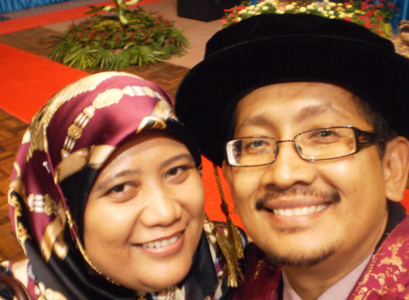
22 SEPTEMBER 2011 - 1 st SUPERVISORS RECOGNITION CEREMONY AND THE WEARING OF THE ROBE FOR PHD GRADUATES - 2 DAYS BEFORE MY GRADUATION DAY

The ceremony organised for the first time today is to recognise and appreciate the sacrifices, guidance, advice and efforts of the supervisors in helping to produce the graduates. UKM Vice Chancellor Prof Tan Sri Dato' Wira Dr Sharifah Hapsah Syed Hasan Shahabudin advised us "KNOWING IS NOT ENOUGH, WE MUST APPLY. WILLING IS NOT ENOUGH, WE MUST DO". Prof Sharifah Hapsah advised the graduates to harness their ideas to create products and services and to also manage high technology projects so as to promote business development in an economy based on innovations. She said the graduates while carrying out their studies and research were guided and encouraged to use their knowledge with integrity whether in the scientific or humanities field and to come up with their thesis presenting new discoveries and findings some of which may affect the people’s lives.


Sunday, 4 September 2011

FINALLY, IN 3 YEARS MY PHD THESIS IS COMPLETED....DR AZMIZAM ABDUL RASHID


This is the best moment in my life. Finally I completed my PhD thesis in 3 years. Syukur sangat berjaya juga siapkan Ist draf tesis pada 15 Ogos 2010, 2nd draf pada 15 Oktober 2011 to my supervisors  dan final submission to deanery office pada 16 Disember 2010. Berkat usaha, tumpuan sepenuhnya kepada kerja-kerja penyelidikan dan doa keluarga terutama isteri tersayang ZUL'AINI ZULKIFLI dan kedua ibubapa aku. Akhirnya aku dapat menyiapkan tesis ini tepat pada waktunya. Ucapan setinggi-tinggi terima kasih kepada kedua-dua penyelia saya Prof Madya Dr Hamzah Jusoh dan Prof Madya Dr Jalaluddin Abdul Malek yang banyak menyumbang idea untuk proses penyelidikan PhD ini . Merekla berdua tidak jemu-jemu memberi ulasan dan pandangan yang membina pada setiap bab dalam tesis ini.


       Tidak lupa juga kepada rakan-rakan di JPBD  yang sentiasa memberi semangat dan panduan semasa penyelidikan PhD dijalankan. Begitu juga dengan rakan-rakan rapat yang lain. Sekurang-kurangnya aku tidak mensia-siakan duit rakyat untuk melanjutkan pengajian PhD ini. Sekarang kena fikirkan sesuatu untuk menyumbangkan ilmu dan pengalaman ini untuk bangsa dan negara. Tesis ini disiapkan tanpa permohonan melanjutkan masa pengajian kepada Jabatan Perkhidmatan Awam (JPA) untuk 4 tahun atau 5 tahun berbanding dengan rakan-rakan lain yang mengambil masa lebih dari 3 tahun hingga 4 tahun untuk menyiapkan tesis mereka.


        Ada juga rakan seangkatanku yang masih belum menyiapkan tesis PhD mereka hingga sekarang. Kenapa agaknya? Jika difikirkan semula melalui pengalaman rakan-rakan kakitangan Jabatan Kerajaan yang cuti belajar untuk melanjutkan pengajian PhD mereka walaupun sudah lebih 4 tahun di UKM. Dalam kotak fikiran mereka "Aku dapat cuti belajar ini tak adalah kena transfer ke bahagian lain atau ke jabatan negeri yang lain atau aku nak berehat secukupnya semasa cuti belajar lepas setahun baru start PhD atau nak duduk rumah jer boleh menonton rancangan TV kegemaranku atau dengan duit biasiswa ini boleh guna untuk renovate rumah".


         Aku nak bagi petua berdasarkan kepada pengalaman aku mengenai 'don't and do' dalam menjalani kehidupan sebagai pelajar PhD di UKM, pertama tanamkan dulu minat yang mendalam 'heart and soul' sebagai penyelidik dalam jiwa kita yang ingin menyambung pengajian dalam PhD.  PhD adalah proses penyelidikan untuk membuktikan perkaitan sesuatu teori kepada permasalahan kajian (reseach question). Adakah perkaitan itu benar atau tidak? PhD bukanlah sesuatu penulisan berbentuk laporan kajian biasa sahaja seperti mana  amalan biasa kita lakukan di jabatan. Penyelidikan PhD itu perlu dibentuk melalui analisis deskriptif and inferensi serta setiap bab itu perlu dijalinkan dengan kemas dan cantik. Kedua, buangkan sifat-sifat ego dan sombong, jangan hanya tahu mengarah itu dan ini lagaknya  seperti seorang CEO. Hormatilah penyelia kita sebagai guru, pembimbing dan sahabat kita. Ketiga, jangan sentiasa biarkan diri anda dalam keadaan selesa sebagai kakitangan kerajaan. Setiap bahan rujukan perlu dicari dan dianalisis dengan bijaksana (wisdom). Amalkan teknik 5W 1H untuk menjawab setiap persoalan dalam sumber rujukan.  Jangan jadikan sumber rujukan di internet sebagai rujukan mudah untuk "cut and paste". Keempat, jangan hanya pandai bercakap seolah-olah kita tahu segalanya  dan mencurahkan idea sahaja tanpa menterjemahkannya dalam bentuk penulisan yang penuh dengan "critical thinking".  Kelima, sentiasa merendah diri, jangan menganggap kita yang paling pandai dalam dunia ini, sebenarnya ada orang lain yang lebih pandai dari kita. Kadang-kadang orang yang tak ambil PhD pun lagi pandai dari kita. Akhir sekali, selalulah berkongsi ilmu dengan rakan-rakan yang sama-sama menjalankan penyelidikan PhD. Jangan kedekut ilmu. Selalu membantu rakan-rakan kita yang lain dalam proses penyelidikan walaupun bidang penyelidikan PhD mereka berlainan. Saya percaya "JIKA KITA SENTIASA MEMPERMUDAHKAN URUSAN ORANG LAIN, INSYALLAH ALLAH AKAN MEMPERMUDAHKAN URUSAN KITA".


          Pengalaman yang tidak boleh dilupakan sepanjang 3 tahun di UKM adalah berpeluang menjalani program 'attachment' di Global City Network and Globalization (GaWC), Loughborough University, United Kingdom selama 3 bulan mulai 22 September 2009 hingga 24 Disember 2009. Program ini  ditaja sepenuhnya oleh JPA. Pada mulanya aku berat hati nak sertai program ini takut mengganggu proses penyelidikan PhD aku. 3 bulan macam-macam benda aku boleh buat di Malaysia. Rupanya sangkaan aku meleset sama sekali. Aku berpeluang bekerjasama dan berkongsi pengalaman penyelidikan ini  di bawah penyeliaan Prof Dr Peter Taylor, Prof Dr Kathy Pain dan Dr John Harrison. Banyak perkongsian ilmu bersama mereka untuk memantapkan tesis PhD aku ini. Rakan-rakan dari negara-negara lain yang sedang menjalankan penyelidikan PhD dalam bilik siswazah di GaWC juga banyak membantu aku. Pengalaman 3 bulan di sana tidak sia-sia begitu sahaja. Segala peluang yang ada untuk menambahbaik tesis aku telah gunakan sebaik mungkin.


          Di Loughborough University juga aku berpeluang membentangkan kertas kerja aku mengenai "Efficient Urban Governance Towards Economic Competitiveness in Kuala Lumpur City-Region" di Delft University, Nertherland pada 24 - 27 November 2009. Di sana juga aku berpeluang berkenalan dan berkongsi pengalaman dengan ramai rakan-rakan dari negara Eropah yang sedang menjalankan penyelidikan PhD. Terima kasih kepada Pusat Pengurusan Siswazah (PPS), UKM dan Fakulti Sains Sosial dan Kemanusiaan (FSSK) UKM yang menaja tiket penerbangan dan yuran pendaftaran seminar ini. Terima kasih kepada Prof Dr Hazita Azman dan kedua-dua penyelia aku yang banyak menyokong dan membantu menjayakan program 'attachment' ini.


          Apabila aku kembali ke Malaysia, aku rasa lebih yakin dengan tesis aku ini yang boleh dianggap sebagai tesis PhD dan bersedia untuk viva. Aku telah melalui proses penyelidikan bermula pada 28 Disember 2008 - 26 Disember 2010. Pada 27 Disember 2010 aku mula lapor diri di JPBD dan 4 Januari 2011 aku ditempatkan di Bahagian Penyelidikan dan Pembangunan JPBD. Sekarang ini aku telah bergelar DR AZMIZAM BIN ABDUL RASHID.Walau bagaimana aku sentiasa berdoa kepada Allah s.w.t semoga aku dijauhi dengan sifat-sifat sombong dan riak. Aku takut kenikmatan yang dikurniakan oleh Allah s.w.t akan ditarik dengan sekelip mata.

Friday, 29 July 2011

MALAYSIAN TOWN PLANNING RESEARCH NETWORK


Research and Development Division, Federal Department of Town and Country Planning has created a Malaysian Town Planning Research Network (MyTOWNnet) website. MyTOWNnet aims to increase knowledge exchange between planning educators, researchers and practitioners. Its purpose is to:

1. Highlight current and proposed research in planning education and practice;

2. Develop international communication in research and educational activity;

3. Promote the exchange of information;

4. Explore new methods of planning education and knowledge development;

5. Encourage the examination of planning theory against practice;

6. Provide a sounding board for futures thinking and innovation; and

7. Support new planning researchers.

MyTOWNnet is open to anyone with an active role in planning and related to policy making, research and education. The website address is http://mytownnet.blogspot.com/. The network will promote Think Tank  and Research Capacity Development to act as sounding boards to allows urban and regional policy makers, researcher and practitioners to get feedback and advice on key issues around urban/rural futures, strategic research and policy issues. Therefore, MyTOWNnet encouraging the investment in knowledge and sharing of information within government and the academic community.

PEOPLE AROUND ME..FAMILY AND FRIENDS.

PEOPLE AROUND ME..FAMILY AND FRIENDS.
To my Wife, Zulaini, my sons Zulazlan, Zulazman, Zulazmir, Zulazmin dan my daughter, Nuris Zulazlin...I love you all..thank you being with me

CIRCLE OF FRIENDS... KUALA LUMPUR PROJECT OFFICE

CIRCLE OF FRIENDS... KUALA LUMPUR PROJECT OFFICE
Thank you guys...for your support and encouragement

2007 / 2008 METHODOLOGY AND QUALITATIVE RESEARCH COURSE FOR PHD CANDIDATES

2007 / 2008 METHODOLOGY AND QUALITATIVE RESEARCH COURSE FOR PHD CANDIDATES
My new friends during my course in INTAN 9 Jan -2 Mac 2007

KUALA LUMPUR PROJECT OFFICE, JOURNEY TO MOUNT OF KINABALU SABAH 21-22 JANUARY 2006

KUALA LUMPUR PROJECT OFFICE, JOURNEY TO MOUNT OF KINABALU SABAH 21-22 JANUARY 2006
WE CAME, WE SAW, WE CONQUERED 4095.2 METER ABOVE SEA LEVEL

How are you, guys? Where you are now?

FOOD CLOCK